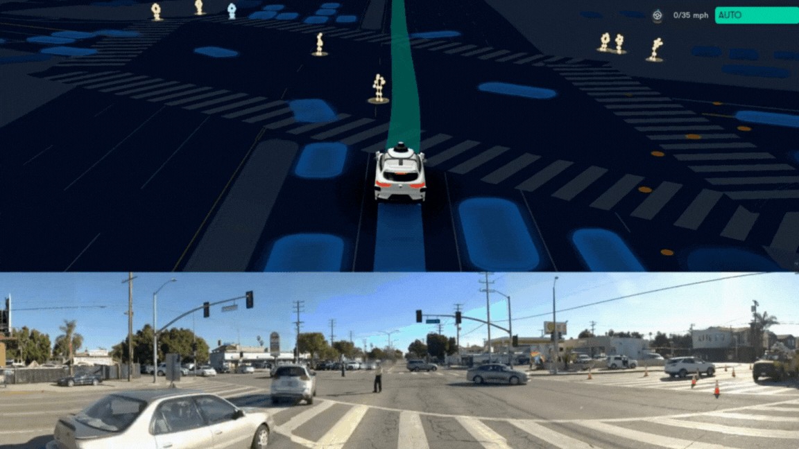
Static first frame extracted without AI from Waymo's official LA road-interaction source clip.
Waymo · Original source · View full size ↗
Image provenance & review status
Shows the article's subject-specific Waymo vehicle interaction in Los Angeles; it is a demonstration frame, not comprehensive performance evidence.
Source date: 2024-03-13 · Retrieved: 2026-09-16.
Faithful static first-frame extraction from the supplied 25.8 MB official GIF; motion is not retained and no AI editing was used. Publication rights: owner review pending.
What happened
Waymo announced on March 13, 2024 that it would begin offering fully autonomous rides to selected members of the public in Los Angeles the following day. The initial area covered 63 square miles from Santa Monica toward downtown. Waymo said those first rides would be free, with paid service planned for coming weeks. It also reported more than 15,000 fully autonomous LA rides during a prior tour and a waitlist above 50,000. In the same announcement, Austin was at a different stage: rider-only testing for employees, with public service intended later. The page includes an official moving image of a Waymo vehicle handling a police officer’s signals in an LA intersection. [1]
Interpretation
The operational point is that an autonomous service launches by territory and permission level, not by a single nationwide switch. An initial geofence, invite list, fare status, and local response procedures all shape the usable product. Reported tour rides demonstrate activity before the limited public opening, but not a complete safety comparison or a profitable service. Austin’s employee stage further shows why a city mentioned in a rollout is not automatically a city with public access. For mobility planners, the transferable lesson is to publish a service boundary that customers can actually understand and to keep testing, free rides, and paid operation distinct. [1]
What to watch
Compare the initial 63-square-mile footprint with later service maps, public eligibility, paid-trip start, pickup reliability, and response to unusual road situations. Evaluate safety with exposure and comparable baselines, not a promotional ride count. If using the official vehicle image, caption it as a demonstrated LA road interaction rather than proof the software handles every officer signal. The historical event is a limited March 14 opening announced a day earlier; later expansion must be documented from later sources. The watch criterion is whether operations can widen the geography and access level while maintaining reliable service, rather than whether one launch post sounds ambitious. [1]
Evidence limits
single_source: one opened primary source supports this brief; independent outcomes remain unverified.
- Single company account of rides and access; no independent safety or economics assessment.
- The observed vehicle visual is a GIF, not an evaluation of all road behavior.
Sources & checked claims
- Scaling Waymo One safely across four cities this yearWaymo · Source date: 2024-03-13 · Retrieved: 2026-09-16
Supports: March 13 announcement and March 14 selected-public start 63-square-mile LA area free initial rides and planned paid service Austin employee-only stage LA vehicle image
Opened official dated post; distinguished observed tour rides, access stage, and future commercial intention.
- Source publication
- 2024-03-13
- Event date
- 2024-03-14 (service-start)
- Discovered / retrieved
- 2026-09-16
- Prepared
- 2026-09-16
- Site published
- Not established in the source record — draft retained
- Timeline date basis
- event
- Rewrite revision
- 1